Published in: iForest
DOI: http://www.sisef.it/iforest/contents/?id=ifor4632-017
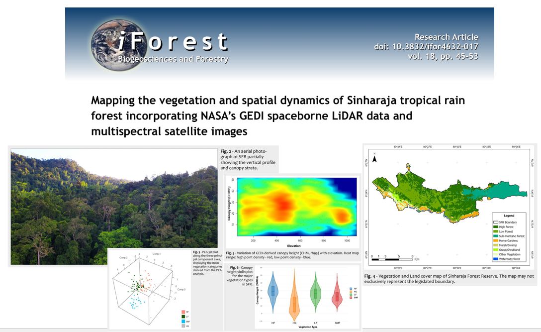
This study integrates NASA’s Global Ecosystem Dynamics Investigation (GEDI) spaceborne LiDAR data with multispectral satellite imagery to map the vegetation and assess spatial dynamics within the Sinharaja Forest Reserve (SFR), located in the southwestern Sri Lanka. Utilizing advanced remote sensing techniques, we delineated vegetation structure, vegetation density distribution, and canopy cover at high spatial resolutions. Eight distinct vegetation/land cover types were identified and an updated vegetation map was developed for SFR. The resulted map recorded an estimated overall accuracy of 90% (Kappa coefficient = 0.9) by the accuracy assessment. Comprehensive insights into forest composition and spatial dynamics were achieved with regard to canopy heights, plant area index and plant area volume density. Our results suggest that the integration of GEDI LiDAR and satellite imaging data offers a robust framework for characterizing tropical forest ecosystems, facilitating better understanding of their ecological processes, and informing conservation and management strategies.